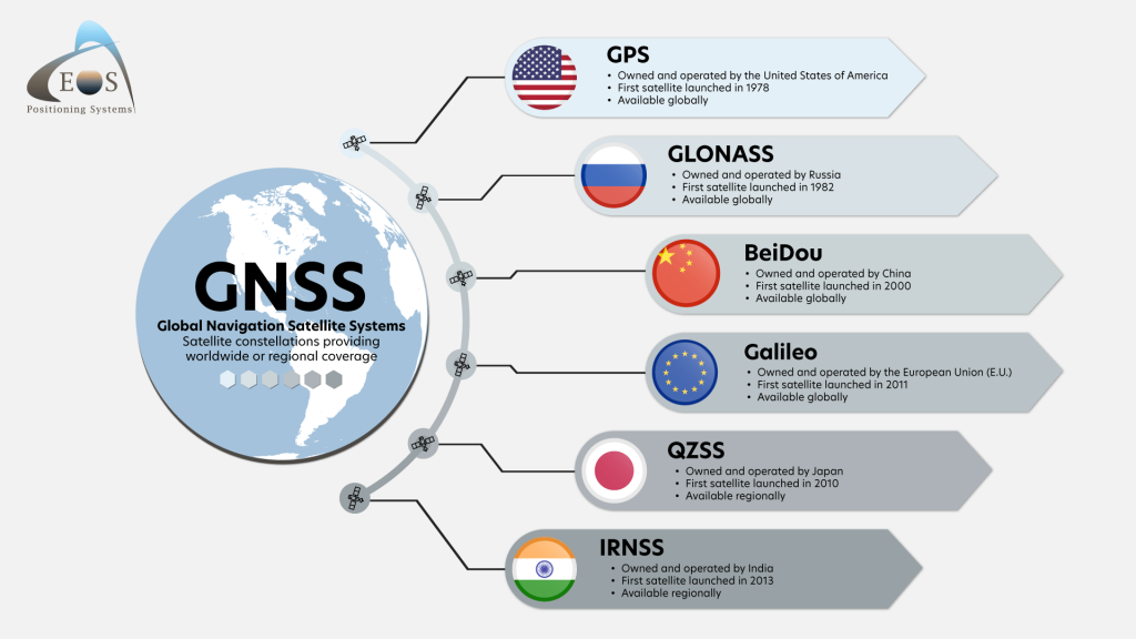
Satellite positioning, also known as GNSS positioning, plays a critical role in modern life. GNSS stands for Global Navigation Satellite System. While GPS is the first and most well-known of these systems, there are also Galileo, GLONASS, and BeiDou. Galileo is Europe’s own global navigation satellite system and the only one specifically designed for civilian use.
Together, these four fully operational GNSS constellations provide global positioning, navigation, and timing (PNT) services. Receivers typically combine signals from multiple systems for improved accuracy and reliability.
GNSS-based positioning is used in many different applications: transport and logistics on land, sea, and air, communication networks, emergency services, agriculture, environmental monitoring, precision mapping, smartphones, fitness trackers, drones, and more.
In short, it is essential for civilians, industries, and governments alike.
So when the signal fails — so do many of the systems we rely on.
A Growing Problem
Problems with satellite positioning have increased significantly since Russia began its war against Ukraine in 2022. Ongoing geopolitical tensions have led to a rise in intentional GNSS interference, especially near conflict zones. This has been particularly noticeable in air and marine traffic — also in Finland.
For example, in August 2024, a Finnair flight from Helsinki to Joensuu had to turn back because it could not land due to GNSS interference. In May 2025, the Finnish Environment Institute’s marine research operations was disrupted in the Gulf of Finland when their vessel was unable to determine its exact location due to signal loss caused by interference.
In the Gulf of Finland, disruption to satellite-based navigation signals has caused vessels to drift off from their intended routes. These disruptions have also impaired the Automatic Identification Systems (AIS) used for electronic navigation, according to the Finnish Coast Guard.
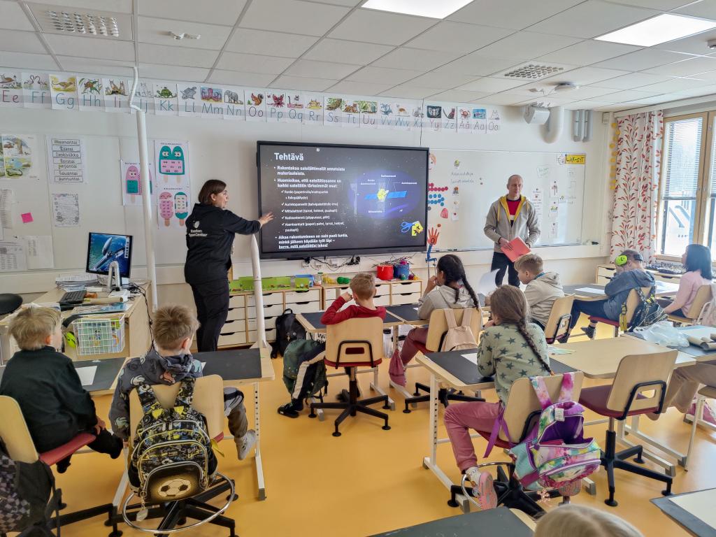
To address this growing threat, the National Land Survey of Finland launched an project in April 2025 to develop methods for detecting GNSS interference in real time and reduce its impact aerial imagery and air traffic.
Learn more on Traficom’s website:
> Satellite navigation service interferences in Finland
Types of GNSS interference
In Finland, Traficom (the Finnish Transport and Communications Agency) monitors how radio frequency usage and identifies sources of interference, including GNSS-related issues.
GNSS interference can be unintentional or intentional. Below are the three most common types:
Read more about the interference types by clicking the boxes below open.
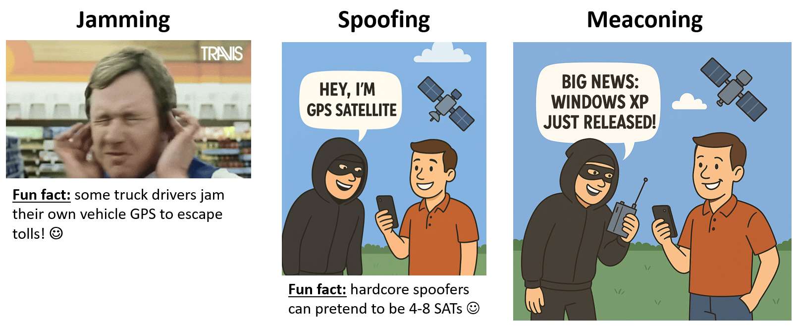
Jamming 🚫
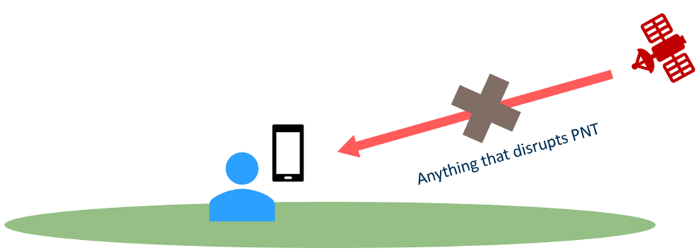
Jamming occurs when no GNSS signal is received at all. It can result from:
Unintentional interference, such as:
- Faulty electronics
- Overlapping wireless signals
- Natural phenomena like space weather, including geomagnetic storms and solar flares.
What else can geomagnetic storms cause?
These storms, which also cause Northern Lights, can interfere with radio signals, disrupt GNSS, cause electrical disturbances, and even damage electrical equipment like geostationary satellites (GEOs) orbiting the Earth at high altitudes.
Intentional interference by signal jammer devices, which are used for:
- Military and law enforcement use for tactical purposes
- Privacy protection by civilians
- Criminal activity, e.g. hiding the location of stolen vehicles.
In Finland, the use of these jammer devices is illegal without prior authorization.
Spoofing 💀
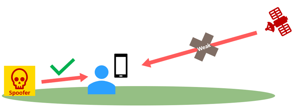
Spoofing is intentional interference where a user does receive a signal, but not from a real satellite. Instead, it is a fake signal generated by a spoofer to mislead the receiver.
The goal is often to manipulate the receiver’s position or time information, which can have serious consequences:
- Vehicles or aircraft being misled into the wrong location
- Tracking system can be bypassed
- Critical systems like power grids or financial networks may malfunction
Meaconing 🔄
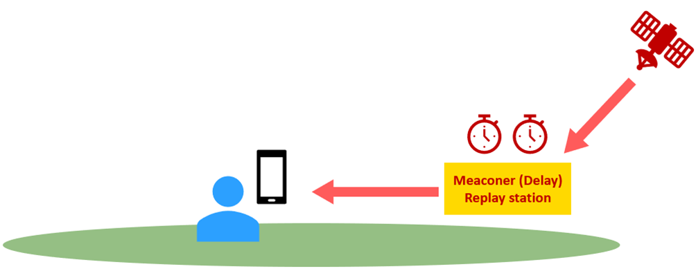
In meaconing, the received GNSS signal is real and comes from a satellite – but it has been intentionally delayed and re-transmitted. As a result, the user receives an authentic signal, just not in real time, which can cause confusion and serious positioning errors.
Because the signal appears legitimate, meaconing is harder to detect than jamming or spoofing and can go unnoticed for long periods. For example, vehicles or aircraft may gradually drift off their intended course without triggering any alarms.
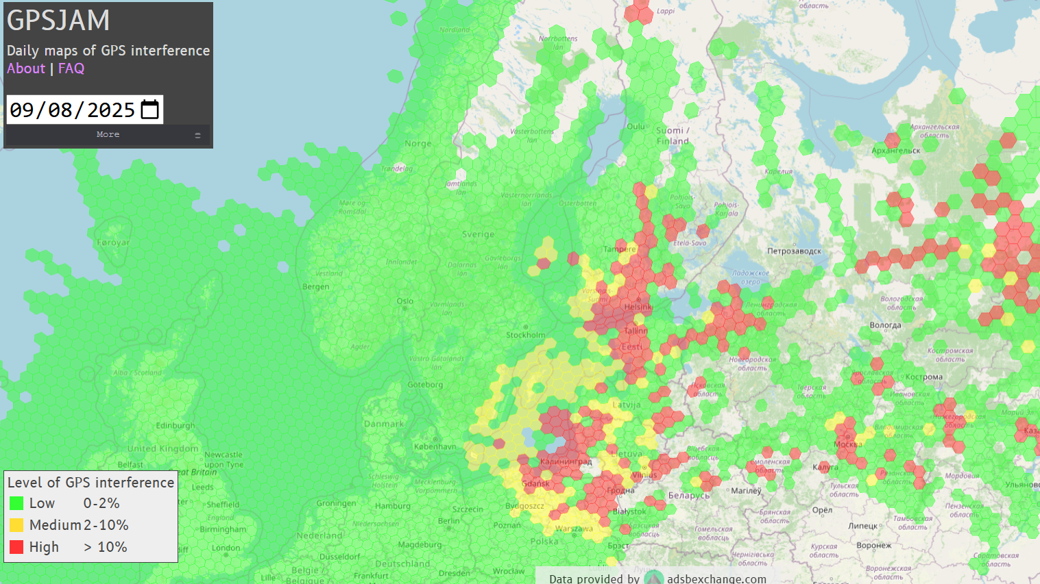
Track Interference in Real Time
You can check daily maps of GPS interference at www.gpsjam.org, which shows areas with the most interference in air traffic. Red indicates a high level of interference. According to the data from September 8, the most affected areas include the Gulf of Finland, the Baltic Sea, Southern Finland, parts of northwestern Russia and around Moscow, the Baltic countries, the Kaliningrad area, and northern Poland.
However, interference shown on the map doesn’t always mean that active jamming is taking place. Rather, it indicates areas where a significant number of aircraft have reported low navigation accuracy. These areas often coincide with regions near conflict zones, where GPS jamming is known to be more common.
Further reading
> GPS jamming? No problem, LEO satellites hold the key to resilient, interference-free navigation
If you have any questions about GNSS interference, you can contact:
Mahmoud Elsanhoury
Postdoctoral Researcher & Kvarken Space Center’s GNSS expertMahmoud Elsanhoury is listed as one of the “10 Top Young Scientists in Finland 2023” by the Technology Academy of Finland, who represented Finland in the Global Young Scientists Summit (GYSS) in Singapore 2024. He completed the doctoral (Ph.D.) degree in computer science and telecommunications engineering at the University of Vaasa, Finland, in 2024.
Thank you to Mahmoud for providing info on the topic and the images! 🛰